Southern Andean Route
13 days · 2,876 km
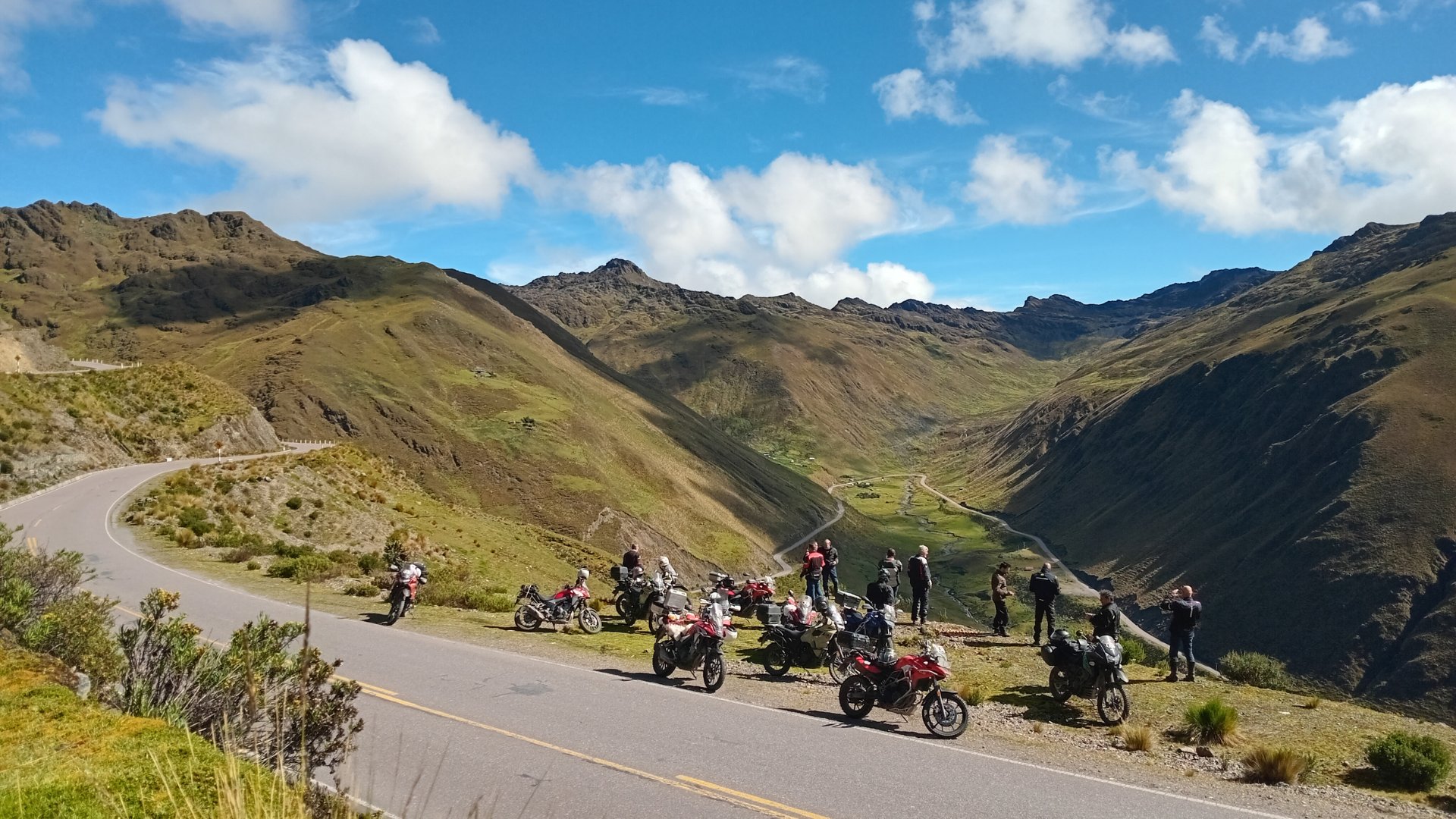
The great southern Peru circuit in 13 days. Desert, altiplano, and Ticlio at 4,818 m a.s.l.
The great southern Peru circuit in 13 days. Desert, altiplano, and Ticlio at 4,818 m a.s.l.
What is the Southern Andean Route?
This isn't a weekend trip — it's the great circuit of southern Peru: desert, altiplano, deep canyons, and one of the highest paved mountain passes on the planet, all in a single loop. Many operators sell it crammed into 7 or 8 very rushed days; we designed it as 13 (12 if you skip the optional Machu Picchu day), because certain stretches (Nazca–Arequipa, Abancay–Ayacucho) are both safer and more enjoyable spread over two days rather than one at the limit.
This is a route for motorcyclists with real experience at altitude, tight mountain curves, and long riding days — it's not the place to break in a new bike or a new rider.
Avoid passing through Ayacucho during Semana Santa (Holy Week) without booking months in advance: it's one of Peru's largest religious celebrations and the city fills up completely. April and November are reasonable transition months, but check the forecast before you go — a single day of heavy rain can temporarily close the Izcuchaca–Mayocc stretch.
Best season
May – September (dry Andean season, the best time for this route).
Avoid
December – March (rains, fog, and risk of landslides in the highlands).
13 days through southern Peru
Lima → Huacachina
flat desert, no mountain passes
Leave Lima before this time to beat the usual traffic — the Pan-American Highway South flows well in the mornings past Chilca.
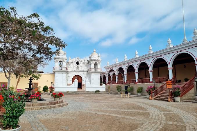
You'll reach Chincha. If you have time, detour to Hacienda San José in El Carmen: a 17th-century hacienda with over 30 km of underground tunnels once used for the slave trade of Africans brought to Peru, now a historical tour. El Carmen is the birthplace of Afro-Peruvian culture — zapateado, cajón, and live music on almost any weekend. Take the chance to have lunch there: carapulcra con sopa seca is the area's signature dish (the restaurant Fiesta, inside the hacienda, serves it exceptionally well). Add 1–2 extra hours if you go inside.
In Ica, if you enjoy pisco, Bodega Santiago Queirolo has centuries of tradition and offers quick tastings without much advance notice.
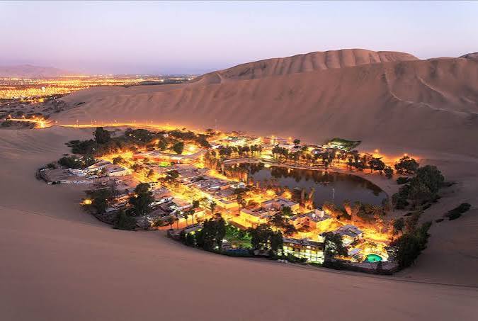
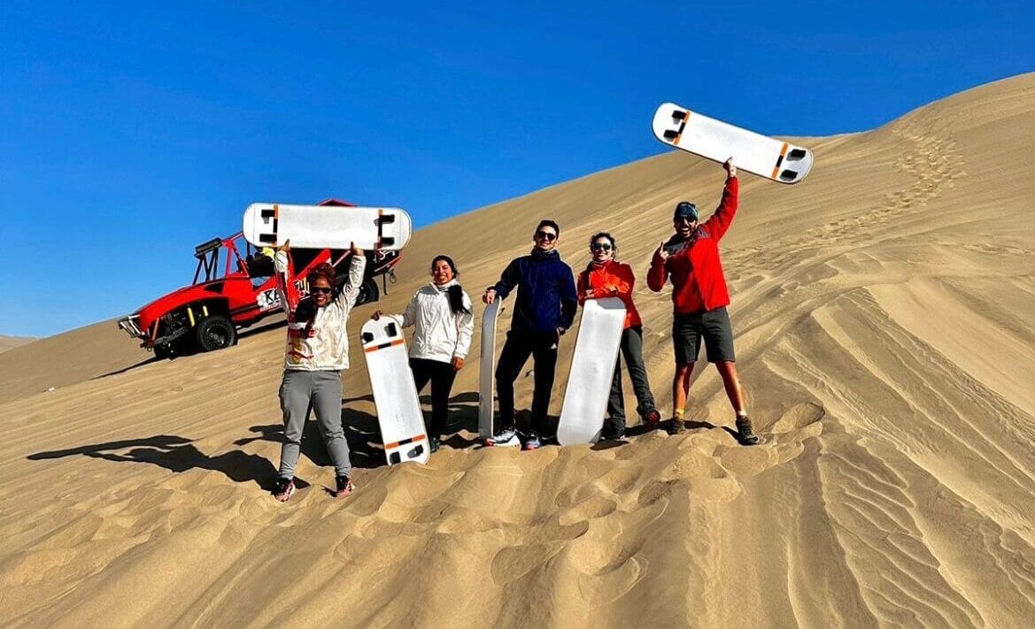
Arrival at Huacachina: it's the most famous natural oasis in South America — a lagoon surrounded by giant dunes in the middle of the desert. Take a dip and climb the dunes at your own pace.
The best moment of the day: sunset from the top of the dunes, with golden light on the sand. Legend has it that a princess was surprised while bathing by a hunter; as she fled she dropped her mirror, which became the lagoon, and her long hair turned into the surrounding dunes — they say her ghost still swims there on full-moon nights.
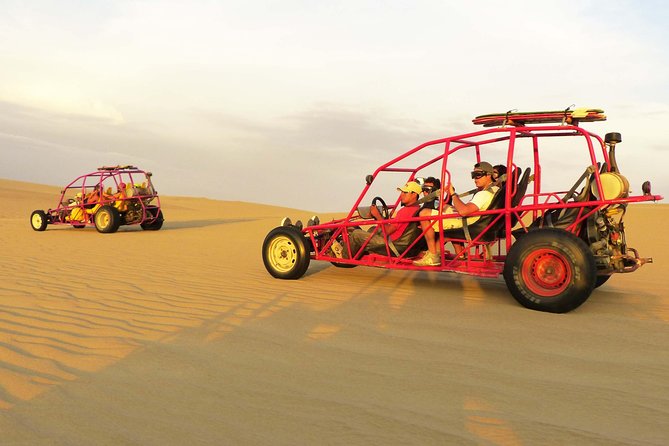
If you still have energy, the buggies (tubulones) leave roughly every hour from the village and last about 1h30 — just in time for sunset.
If you'd like to explore the Reserva Nacional de Paracas at your own pace — with its Laguna Rosada, a saltpan dyed deep pink by microorganisms and ringed by flamingos — consider adding an extra day here. The 13-day base route doesn't include it, but if you have the time, it's worth every extra hour.
- Chincha / El Carmen — Hacienda San José (history and carapulcra con sopa seca)
- Ica — Bodega Santiago Queirolo (pisco)
- Paracas (optional detour to the National Reserve and Laguna Rosada — add a day if you do it)
Hotel Mossone — Huacachina, Ica
The only hotel with direct access to the Huacachina lagoon — colonial and charming. Book ahead during high season.
Huacachina → Nazca
coastal plain
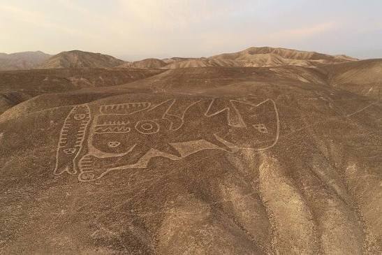
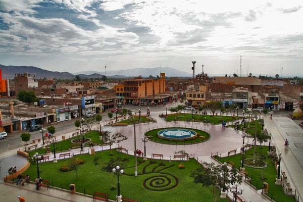
Leave after breakfast — no rush today, it's the shortest riding day of the entire route.
On the way you'll pass near Ocucaje, famous for its pisco wineries and also a paleontological site where whale fossils millions of years old have been found — from when this desert was seafloor.
Optional detour to Palpa to see its own line viewpoint — many people skip it in favor of going straight to Nazca, which is a shame: far fewer people here and equally impressive figures (the 'solar clock,' 'the family').
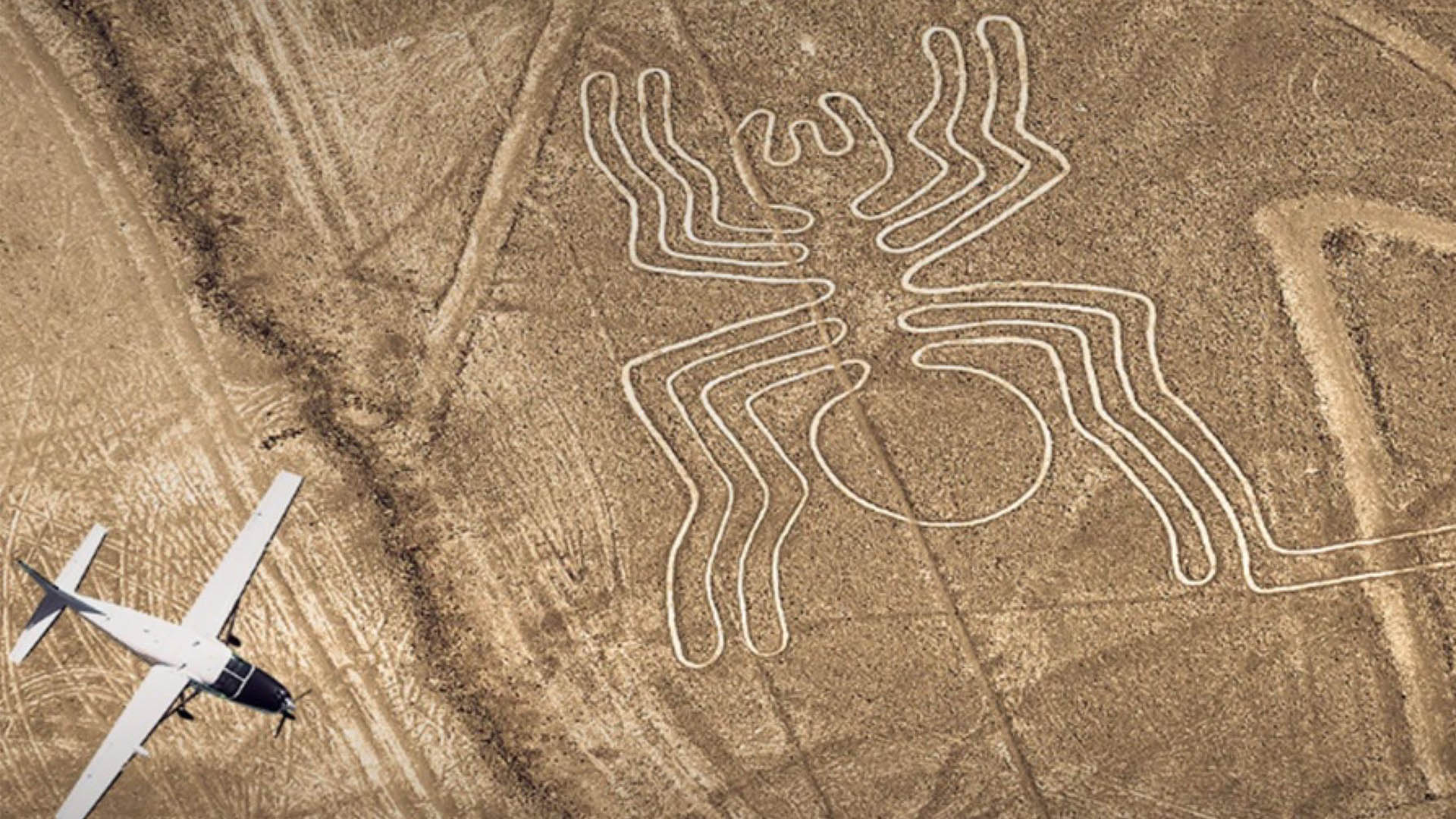
Arrival in Nazca. If you want to fly over the lines, flights depart between 7:00 a.m. and 1:00 p.m. from the María Reiche airport at the entrance to town — arrange it today or leave it for tomorrow morning.
No one knows for certain why these lines were drawn — a UNESCO World Heritage Site since 1994. Astronomical calendar, ceremonial paths, or messages to the gods are just a few theories. Maria Reiche, the German mathematician who dedicated over 40 years of her life to studying and protecting them, reportedly swept the sand herself with a broom to keep them visible.
Leave the bike at the hotel's parking and walk the center — it's small and easy on foot.
Acueductos de Cantalloc, about 3.5 km from Nazca: an underground irrigation system built by the Nazca culture, with spiral wells through which people accessed water in the middle of the desert. Short and easy for the afternoon.
Museo Antonini, with pieces recovered from the ceremonial center of Cahuachi. Confirm the closing time with your hotel.
Want something more intense? The Chauchilla cemetery is about 30 km south of Nazca, with mummies in their original tombs. The trip takes roughly 25 minutes and the visit about 2 hours. Easiest with a private tour or taxi from the hotel. If you choose this, leave at 2:00 p.m. instead of going to Cantalloc.
Dinner in the center. Three options: La Kasa Rustika (Av. Bolognesi 372), known for lomo saltado, ceviche, and a solid set menu. Mamashana Café Restaurante, with Peruvian cuisine and Mediterranean touches. And D'Gula for seafood.
Express alternative: Huacachina → Camaná in a single day. It is doable, but it is the longest leg of the whole trip: 540 km (150 + 390), about 150 km more than the longest riding day on the route (390 km). Budget 9–10 hours with stops: leave at 5:30 a.m. to arrive before sunset. Fill the tank in Nazca and again in Chala. With this option you skip Nazca (the overflight, Cantalloc, and Chauchilla) and lose part of Puerto Inca, but you save a day. We only recommend it as an express alternative for very experienced riders.
- Ocucaje (wineries and marine fossils)
- Palpa (line viewpoint, far fewer crowds)
- Cantalloc (aqueducts)
- Museo Antonini
- Chauchilla (optional)
Casa Andina Standard — Nazca town center
Reliable chain with guarded parking in central Nazca — ideal after a full day crossing the desert.
Nazca → Camaná
the longest and most solitary stretch of the whole route
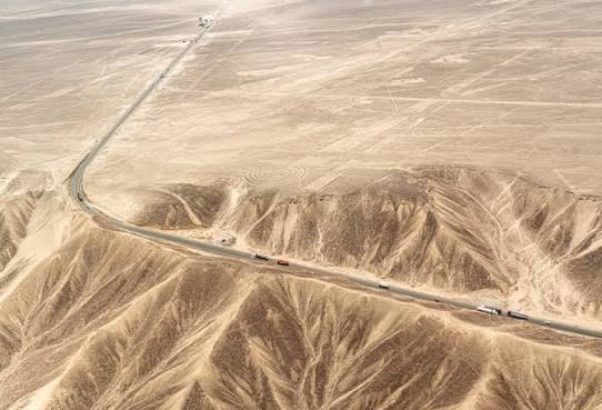
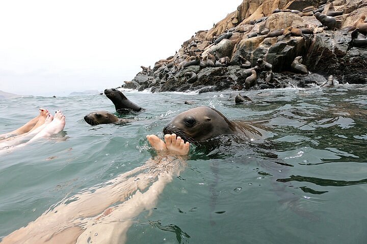
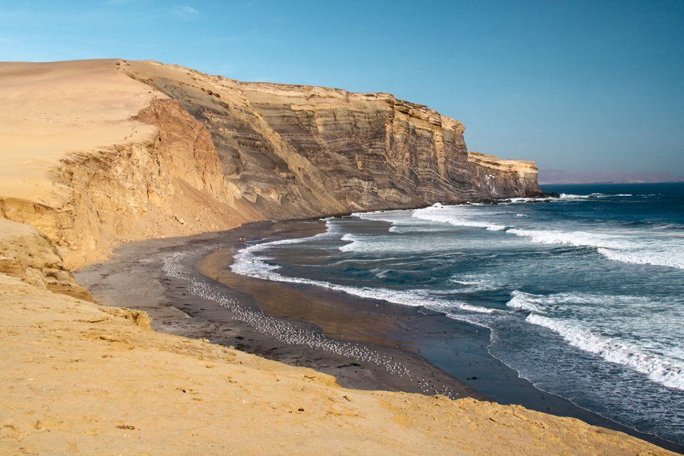
Leave very early — this is the longest and most solitary day of the whole route, riding the Pan-American Highway South, part of the Panamericana: the longest driveable road in the world, connecting Alaska to the southern tip of Argentina over more than 30,000 km.
Fill the tank before leaving Nazca — between Chala and Ocoña there are stretches of over 100 km with no gas station.
Optional detour to San Juan de Marcona: sea lions and, in season (July–October), humpback whales close to shore.
Chala — fill up again. The crosswind picks up hard after midday, so you should already have good progress by now.
Detour to Puerto Inca, one of the route's favorites: pre-Inca ruins built above a turquoise cove, where Inca royalty had fresh fish delivered all the way to Cusco — a relay chain of chasquis (runners) covered nearly 500 km in under two days, no horses, no wheels.
Arrival in Camaná with the sun already low — perfect to end the day with your feet in the sand.
- San Juan de Marcona (optional detour — sea lions, whales in season)
- Puerto Inca (pre-Inca ruins by the sea)
- Chala and Ocoña (fill up whenever you can — stretches over 100 km without a gas station)
Hotel by the sea (e.g. El Cesar's) — Camaná waterfront
Beachfront — perfect for closing the desert day with your feet in the sand. Confirm guarded parking when booking.
Camaná → Arequipa
ascent through the Majes valley, including the 'cuesta del toro'
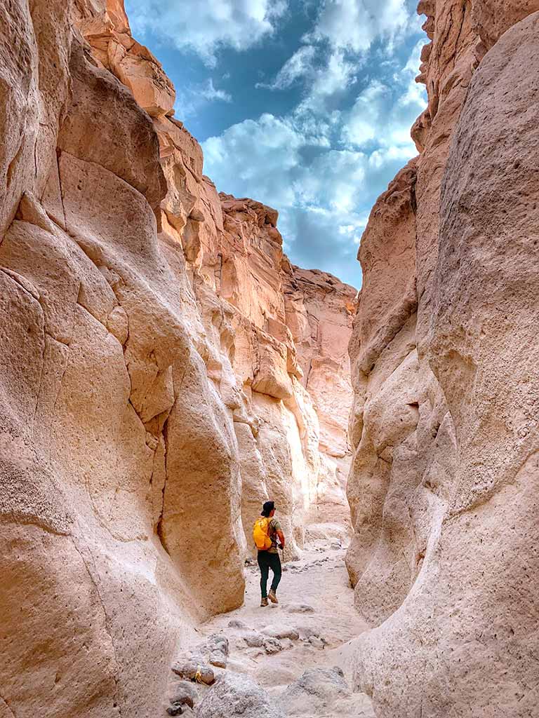
Leave after breakfast, no rush — a relaxed day of just 175 km.
Climb through the Majes valley: green fields of rice and onion up to the famous cuesta del toro, a tight-curved ascent marking the shift in scenery from fertile valley to dry puna.
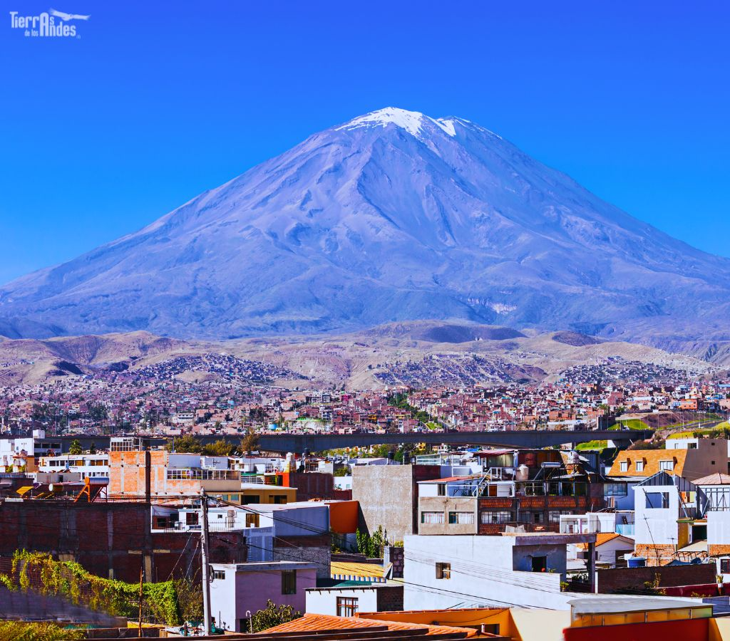
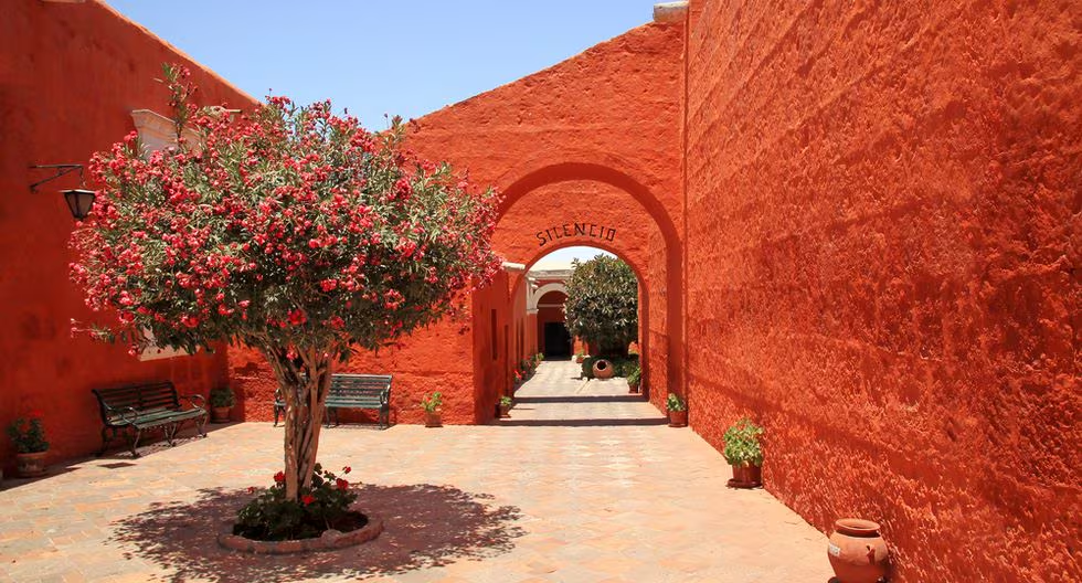
Arrival in Arequipa, the 'White City' — ringed by volcanoes: El Misti, Chachani, and Pichu Pichu watch over it from every street. Its historic center, a UNESCO World Heritage Site, is built almost entirely in sillar, a white volcanic stone that changes tone as the day progresses.
The Monasterio de Santa Catalina usually closes around 5:00 p.m. — it's an entire colonial citadel within the city itself, not to be missed.
At the Museo Santuarios Andinos you can see Juanita, the 'Lady of Ampato': an Inca girl sacrificed at the summit of Ampato volcano over 500 years ago, left frozen and perfectly preserved until she was found in 1995.
Mirador de Yanahuara, a few minutes from the center by taxi or on foot: 19th-century sillar arches engraved with verses by Arequipa poets, with a view of the three volcanoes and El Misti at the center. Arrive with light — best moment of the day for photos.
El Misti (5,822 m a.s.l.), with its nearly perfect conical shape, is Arequipa's emblem — locals are nicknamed 'mistianos' after it.
Close the day with something classically Arequipeño — a rocoto relleno or a chupe de camarones — you've earned it after two days of desert.
- Majes valley / Aplao (cuesta del toro)
- Characato (optional viewpoint of the three volcanoes)
- Mirador de Yanahuara (sunset with three-volcano view)
Casa Andina Premium or Katari Hotel — historic center, Arequipa
In the heart of the white sillar historic center, steps from the Plaza de Armas, with private parking.
Arequipa → Puno
Leave early — this stretch climbs seriously, from 2,335 m a.s.l. to over 4,400 m a.s.l. in a couple of hours. Take it easy and drink water often: altitude sickness (soroche) can appear without warning.
Imata area — last place with services before open altiplano. Fill up here.
The landscape shifts completely: from Arequipa's volcanoes to open puna, with herds of vicuñas and llamas grazing freely — ride carefully, they cross the road without warning.
On the altiplano the wind picks up hard by mid-afternoon, so try to have a good lead toward Puno by now.
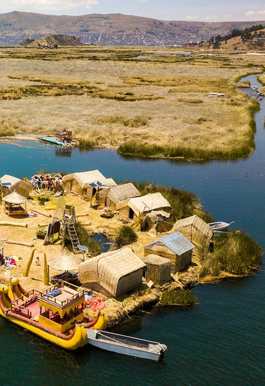
Arrival in Puno, on the shores of Lake Titicaca, considered the highest navigable lake in the world.
According to legend, Manco Cápac and Mama Ocllo emerged from its waters sent by the Sun god, with the mission of founding the Inca empire — which is why it is considered the birthplace of the Incas.
Walk down to the malecón to watch the sunset over the lake; at this altitude the colors are unlike anything else on the route.
- Yura / Imata (last services before open altiplano)
- Santa Lucía (fuel stop and rest, already on the altiplano)
Casa Andina Premium or Sonesta Posada del Inca — lakeside, Puno
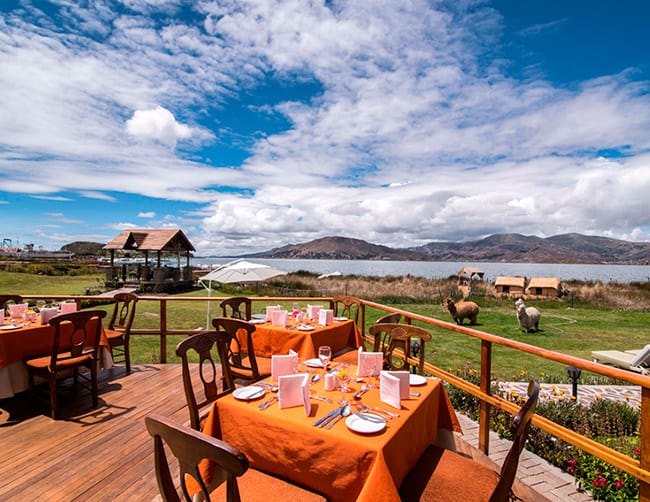
On the shores of Lake Titicaca, with lake views from several rooms — very welcome after a full day at altitude.
Puno → Cusco
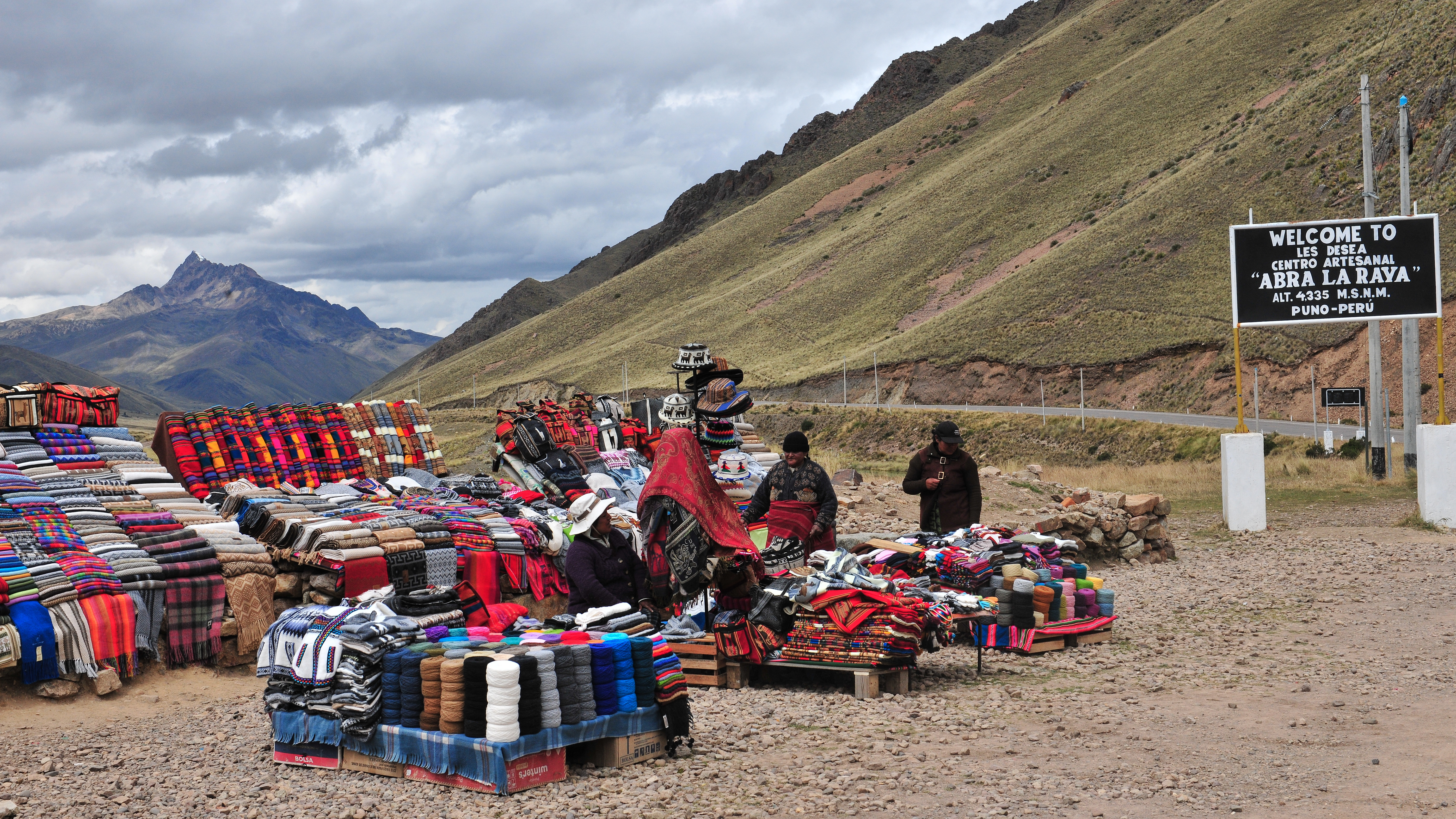
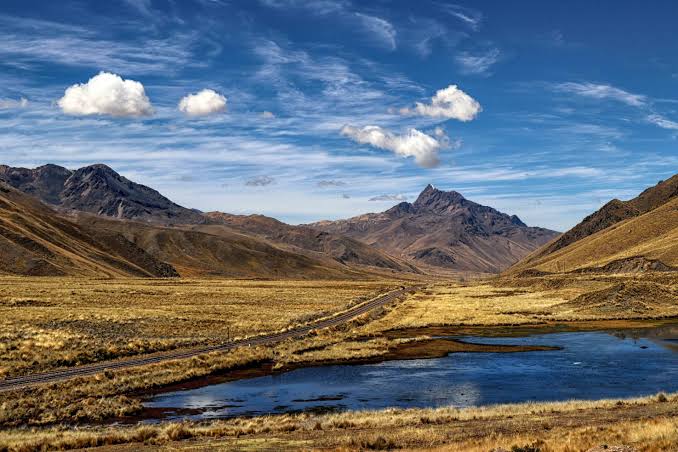
Leave early to avoid arriving in Cusco at night and in a hurry.
Pucará: open puna, where the famous 'toritos de Pucará' are made — ceramic bull figurines you see on almost every rooftop in the southern highlands, placed in pairs as a symbol of protection and prosperity.
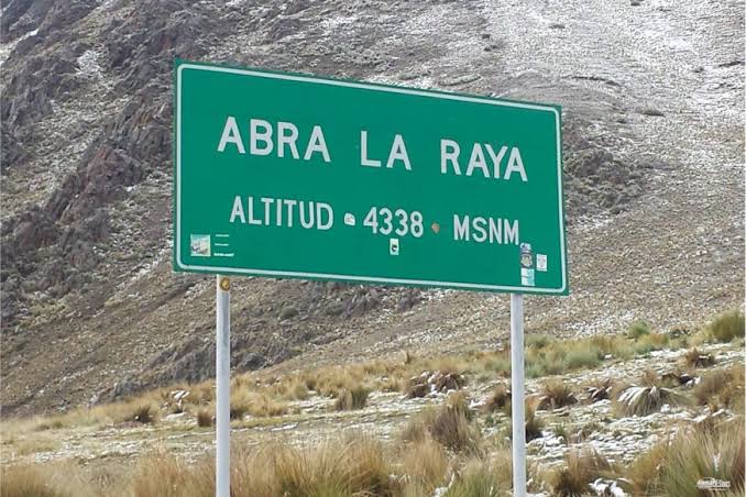
Abra La Raya, 4,338 m a.s.l., the highest point of the entire stretch — you'll feel the cold the moment you get off the bike. From there you can see the Chimboya snowcap, from which — according to local tradition — the sacred Vilcanota River is born, a waterway the Incas considered an earthly reflection of the Milky Way.
Sicuani — a good place for lunch.
Raqchi: the Temple of Wiracocha usually opens until 5:00 p.m. — its walls of nearly 20 meters tall are among the best-preserved Inca remains in the south.
Andahuaylillas and its 'Sistine Chapel of the Americas': plain colonial church on the outside, inside covered floor-to-ceiling with gold leaf and Cusco School paintings.
You'll enter Cusco at dusk; the streets in the center are narrow and cobbled, so ride slowly and confirm with your hotel how to bring the bike to the door.
- Pucará (ceramic bulls, Museo Lítico)
- Abra La Raya (rest stop at 4,338 m a.s.l., photo with Chimboya snowcap)
- Sicuani (lunch)
- Raqchi (Temple of Wiracocha)
- Andahuaylillas (Sistine Chapel of the Americas)
Boutique hotel — San Blas, Cusco
Cobbled streets, close to the center. Book private parking well in advance — the historic center has narrow streets and restricted access. Reserve 2 nights, or 3 if you do the optional Day 8 to Machu Picchu.
Cusco — Rest day
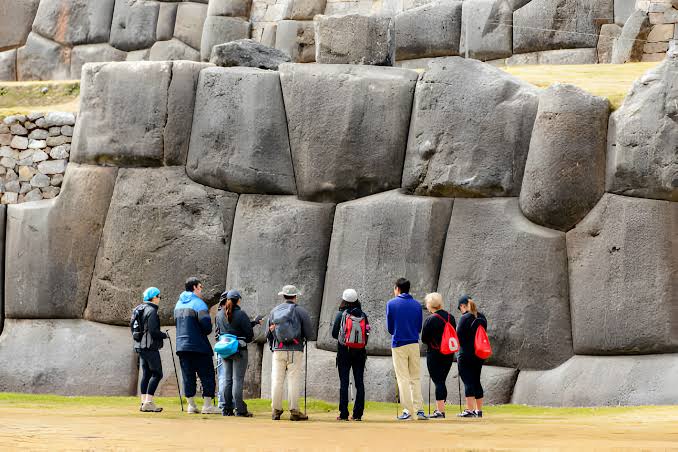
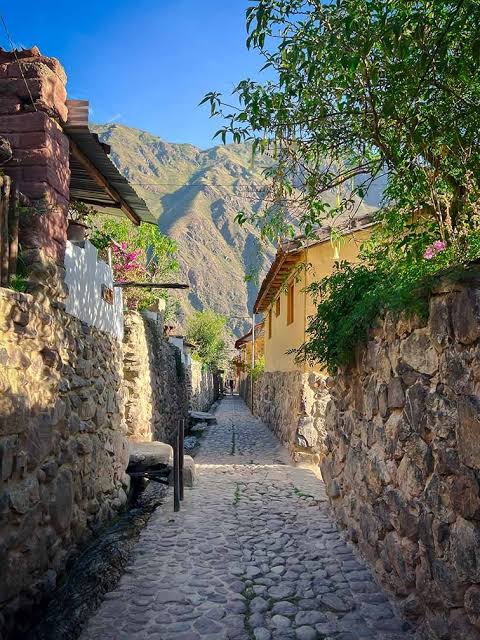
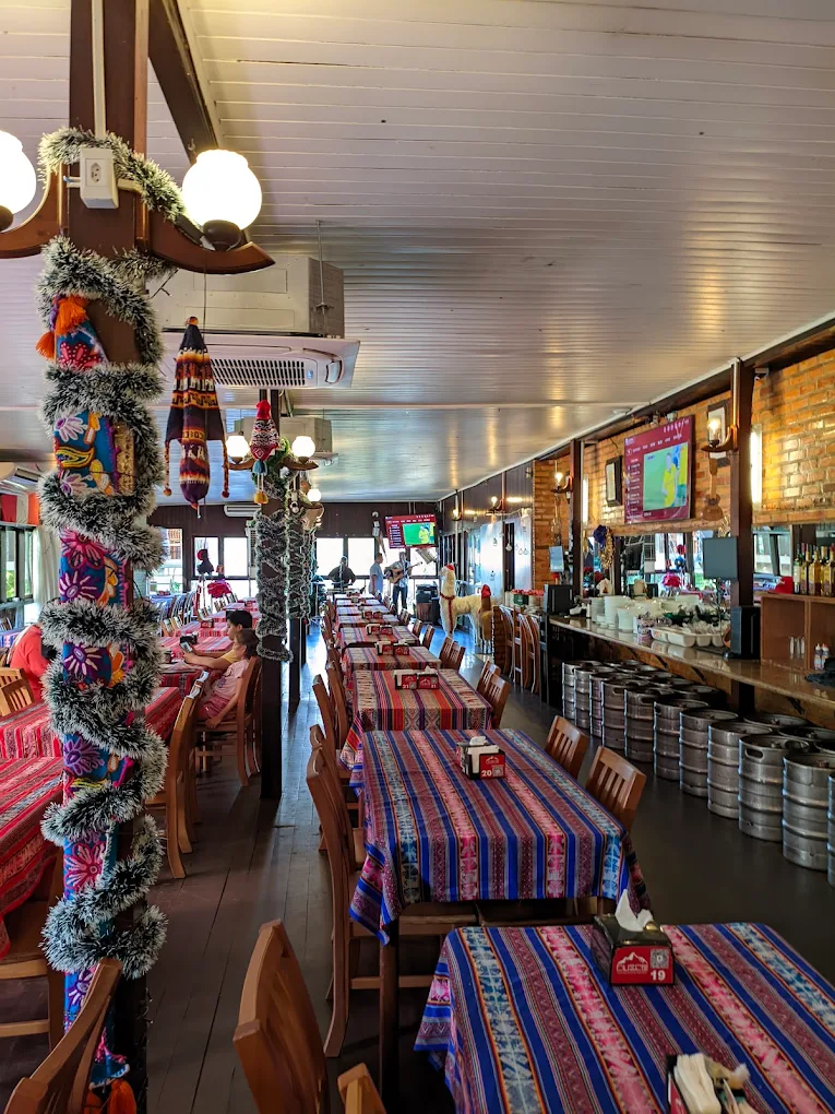
No bike today — and that's a good thing. After six straight days of riding and altitude, your body needs this break before heading back into the climbs and descents toward Abancay. At altitude, start light and drink coca tea.
Relaxed breakfast in San Blas or at the Mercado de San Pedro. Walk the center at your own pace: Inca tradition holds that Cusco's street layout was designed in the shape of a puma, with the Qorikancha as the tail and Sacsayhuamán as the head. If you choose a city tour or the Sacred Valley, this is departure time.
Morning — your choice:
- Sacsayhuamán: opens from 9:00 a.m. Take it easy going up, walk back down to the center.
- Walk the center: Plaza de Armas, Hatun Rumiyoc street with the 12-Angle Stone, Loreto street, and San Blas.
- Half-day city tour (~5 hours): Cathedral, Qorikancha, Sacsayhuamán, Q'enqo, Puka Pukara, and Tambomachay. Morning departure at 8:30 a.m. Tickets bought on the day.
- Sacred Valley, full day: Pisac and Ollantaytambo are an excellent way to make the most of the rest day without pushing your body.
Lunch. Options: set menu at the Mercado de San Pedro, or a restaurant in the center (see dinner options below).
Free afternoon. Options:
- Afternoon city tour: departs around 12:30 p.m. and finishes near 6:00 p.m.
- Qorikancha and the Cathedral, if you did Sacsayhuamán in the morning.
- Museo de Arte Precolombino and craft shops in San Blas.
- Rest at the hotel.
Dinner. In high season, book ahead:
- Cicciolina: Peruvian-Italian cuisine with alpaca and house-made pasta.
- Uchu Peruvian Steakhouse: alpaca and meats seared on volcanic stone.
- MAP Café: creative cuisine in the courtyard of the Museo de Arte Precolombino, Plaza Nazarenas.
If you're doing Machu Picchu tomorrow, keep today light and get to bed early — you'll be leaving before dawn.
Same hotel as Day 6 — San Blas, Cusco
This is the extra day most tours don't give you — essential for genuinely acclimatizing before continuing through the Apurímac ups and downs.
Cusco → Machu Picchu
lower than Cusco, no altitude issue
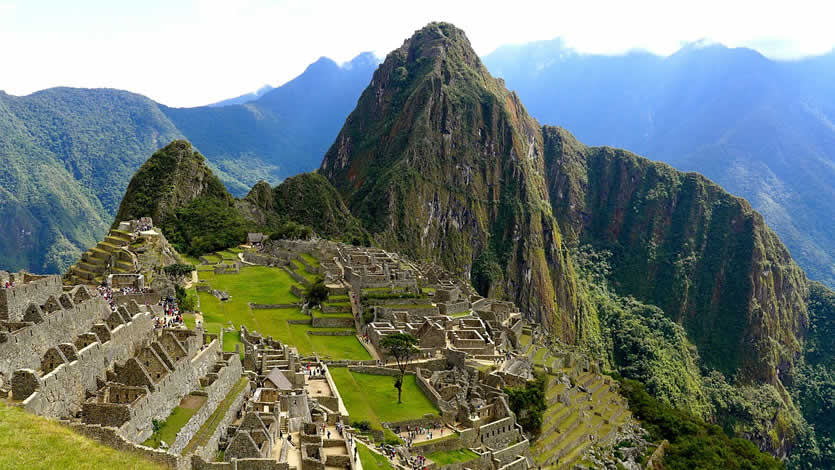
Optional day for those who already have their tickets and trains booked. The bike stays in the secure garage at your Cusco hotel. If you don't have tickets, skip this day and go straight to Day 9.
- →Machu Picchu tickets: tuboleto.cultura.pe, the official platform. The ticket is non-transferable: it is only valid for the registered date, time, circuit, and name, and neither the date nor the name can be changed. If unused, it is forfeited. Buy when your dates are confirmed, and bring your original passport.
- →Trains: perurail.com and incarail.com. Choose your entry time first, then find the train that fits.
- →Shuttle buses: comprar.consettur.com, the official operator. There is also a Consettur office in Aguas Calientes, but buying online saves you the queue.
- →In May–September everything sells out fast: book at least one to two months ahead.
Head to your train from Poroy (Cusco) or Ollantaytambo. From Poroy the journey takes about 3 hours; from Ollantaytambo about 2. Schedules vary by operator and season — choose the one that gets you to Machu Picchu Pueblo with enough margin before your entry time.
Arrival at Machu Picchu Pueblo (Aguas Calientes). Have your bus ticket ready if you're taking the bus up.
Your choice:
- By bus: the ride takes about 25 minutes. Buses leave every 10 minutes, starting around 5:30 a.m.
- On foot: a staircase trail that takes 1 to 1.5 hours. Only if you have the energy.
Arrive within your entry window. Once you leave, you cannot re-enter, so use the restrooms and the entrance café before you start.
With a guide or on your own? There are usually several licensed guides at the entrance offering their services, all bilingual. In our experience it wasn't required — you can go in alone or with a guide. That said, our recommendation is 100% to go with a guide: they teach and narrate the whole history of this wonder of the world. The route is truly beautiful, and being there and learning about the Inca culture up close feels different. Rules change, so confirm what's currently required before you travel.
Tour of the citadel. The visit takes between 4 and 6 hours depending on the circuit.
Lunch in Machu Picchu Pueblo, before or after your visit depending on your schedule.
Return train. You'll arrive in Cusco at night, so buy your return ticket with plenty of margin.
Bring your original passport, layers, a rain poncho, sunscreen, and a small daypack. Large luggage stays at the hotel.
Same hotel as Days 6 and 7 — San Blas, Cusco
Your bike stays in the private garage.
Cusco → Abancay
Leave mid-morning — no need for an early start since it's a short stretch. If you're coming from Machu Picchu, this timing is already built in for you.
Curahuasi — last major stop with services before the canyon. Fill up here.
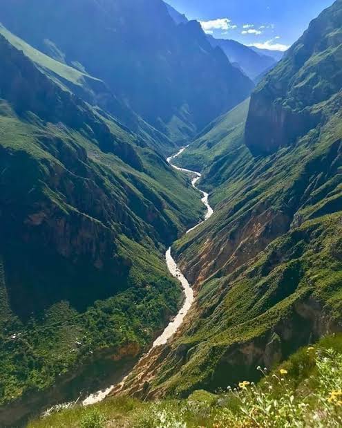
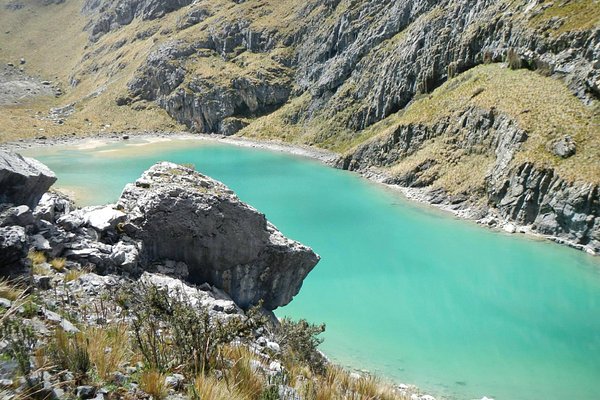
The descent into the Apurímac canyon begins: from 3,399 m a.s.l. down to roughly 1,700 m a.s.l. at the canyon floor — one of the most dramatic stretches of the whole route, with tight curves and views that'll have you stopping every few minutes for photos.
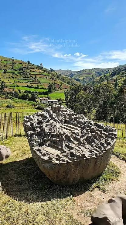
Detour to Saywite, 47 km before Abancay — usually open until 5:00 p.m.: its main monolith has over 200 carved figures — animals, water channels, miniature temples — that archaeologists still debate: religious model, territorial map of the empire, or ceremonial observatory.
Arrival in Abancay with plenty of daylight left to settle in comfortably.
- Curahuasi (last major fuel stop before the canyon descent)
- Bridge over the Apurímac river (most dramatic descent and ascent of the route)
- Saywite (archaeological complex, 47 km before Abancay)
Hotel Contreras — Abancay town center
Wide, secure parking inside the hotel itself, confirmed for trucks and motorcycles — essential in a town where leaving a bike safely on the street can be tricky.
Abancay → Andahuaylas
Leave whenever you're ready — another short day, designed so you don't arrive exhausted in Ayacucho the day after.
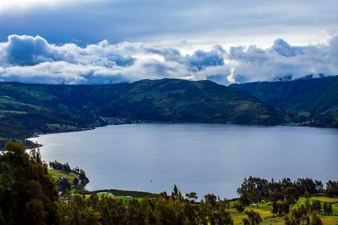
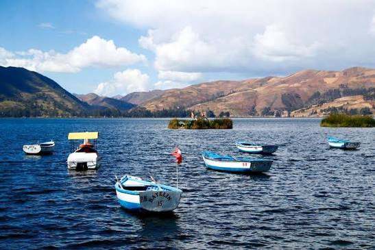
Detour to Laguna de Pacucha (about 20 minutes from Andahuaylas) — a beautiful spot to have lunch by the water. In the lakeside village there are places to rent boats for rowing; if you're interested, just ask when you arrive.
Right next door, Sondor: a Chanka ceremonial site linked to the legends of that people's origins — the same Chanka who clashed with the Incas before the empire's expansion under Pachacútec. Far less visited than the more famous Inca ruins, you'll usually have it nearly to yourself.
Arrival in Andahuaylas — a small, quiet town.
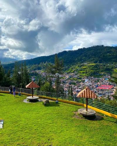
Free afternoon to explore: the Plaza de Armas with the Cathedral de San Pedro, and the small Museo de Andahuaylas.
Mirador del Apu Huayhuaca, about 5 km from the center, surrounded by pines and cypresses, with a wide view of the whole valley. A good way to close the afternoon before dinner.
In the Andean worldview, an 'apu' is a mountain or hill considered a protective spirit — Apu Huayhuaca holds that meaning for the local community.
Simple dinner in the center: Andahuaylas' restaurant scene is more basic than the cities earlier on, so a set menu or something à la carte at a plaza restaurant is the safe bet.
- Valle de Chumbao (viewpoints and bridges)
- Laguna de Pacucha and Sondor (recommended detour)
- Mirador del Apu Huayhuaca
Central hotel with parking — Andahuaylas
Simple but secure, in the center of Andahuaylas — perfect for splitting the Abancay–Ayacucho stretch over two days instead of forcing nearly 400 km of curves in one shot.
Andahuaylas → Ayacucho
Leave early — it's still pure highlands with curves the whole way, though the road is better than the previous stretch. During the rainy season (December to March) this section can have rockfall or damaged sections; if you're traveling then, check road conditions with locals before you leave.
Chincheros — a good mid-morning stop. Don't confuse it with the Chincheros near Cusco; this is a lesser-known textile village with craft just as beautiful. Also a good chance to stretch your legs: back-to-back curves are more tiring than they look.
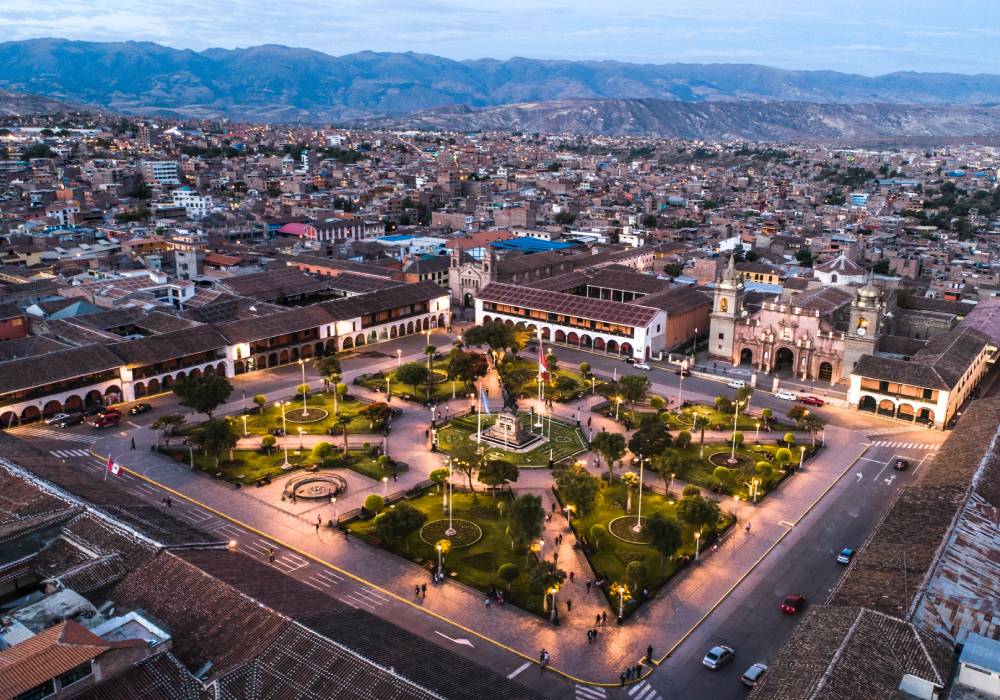
Arrival in Ayacucho, known as the 'city of 33 churches' for its remarkable number of colonial temples.
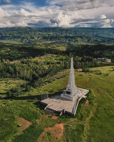
Nearby, on the Pampa de Quinua, the battle that sealed the independence of all of South America was fought in 1824 — today a 44-meter obelisk, one meter per year until 1974, marks the exact spot where the Spanish capitulation was signed.
Drop your things at the hotel and have something local for lunch: puca picante (pork cracklings and potatoes with toasted peanuts) or mondongo ayacuchano.
Free afternoon. Two ways to spend it:
- By motorcycle: north of the city, about 22 km out, is the Complejo Arqueológico de Wari, one of the largest pre-Inca citadels in the country, with over 2,000 hectares and an underground water system that's remarkable for its era. Nearby is the village of Quinua, famous for its retablos and ceramics (the same church-shaped roof pieces you see all over the region), and right there the Pampa de Quinua with the obelisk mentioned above. You can do it all in one round trip.
- On foot from the hotel: the Santa Ana neighborhood, about 10 blocks from the Plaza Mayor, is the heart of Ayacucho's textile craft. Several families have open galleries around the Plazuela de Santa Ana, where you can see hand-woven pieces and talk to the artisans.
If your dates overlap with Semana Santa (Holy Week), brace yourself — the city is packed: it's one of Peru's biggest religious celebrations, with processions that go all night. Outside those dates, it's a calm, beautiful city for an evening walk through the center.
- Chincheros (traditional textiles — not to be confused with the one near Cusco)
- Uripa
- Complejo Arqueológico de Wari and village of Quinua (optional, by bike)
- Santa Ana neighborhood (textile crafts, on foot)
Casa Andina Standard — historic center, Ayacucho
Reliable chain, well located near the historic center, with private parking. Book well in advance if your stay falls during Holy Week.
Ayacucho → Huancayo
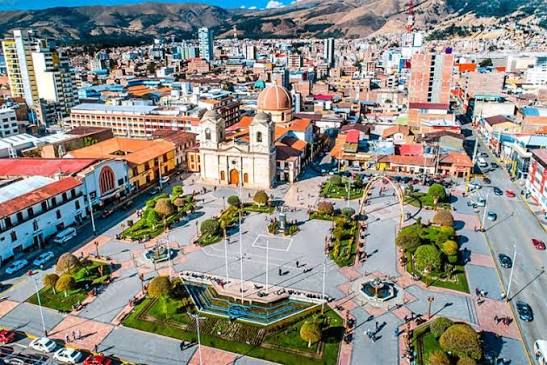
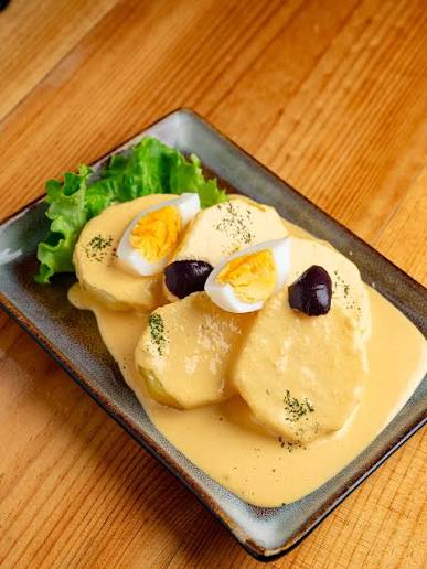
This is the stretch that demands the most respect of the entire route — read it carefully before you leave.
Leave early. The first section to Huanta is in good condition and calm.
Huanta — gas and something to eat.
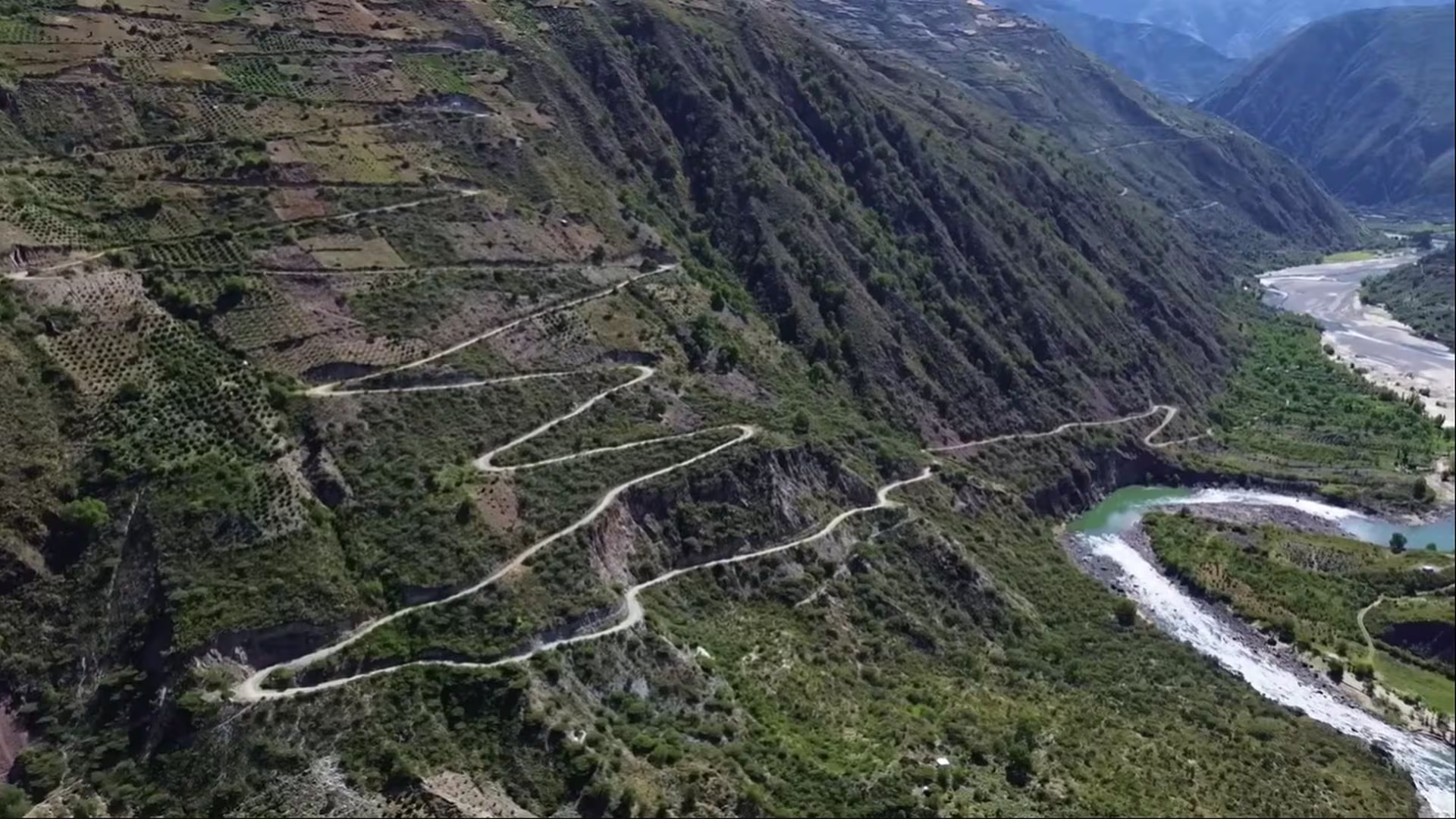
Mayocc: the transition point into the most delicate stretch. Between Izcuchaca and Mayocc, this road has long been known locally as the 'carretera de la muerte' (death road) for its narrowness, blind curves over the Mantaro river canyon, and sections still unpaved (confirm conditions with locals before you leave).
If the report isn't good or you're riding in rain, take the longer alternative via Huancavelica. If you go the direct route, do it in daylight, without rushing, and with a clear head.
Arrival in Huancayo.
Free afternoon to rest your legs after the hardest stretch of the route. If you have energy left, Parque Túpac Amaru and the Cerrito de la Libertad make for a short, pleasant city walk.
Dinner with something typical of the central highlands: papa a la huancaína (born right here, despite the name making it sound like it might be from elsewhere) or a pachamanca if the hotel or a restaurant offers it that day.
The abolition of slavery in Peru was signed right here in Huancayo, on December 3, 1854 — the same thread we picked up on Day 1 at the Hacienda San José in Chincha closes, in a way, right here.
- Huanta (fuel and lunch)
- Mayocc (transition point into the most demanding stretch)
- Parque Túpac Amaru and Cerrito de la Libertad (Huancayo)
Hotel with parking — Huancayo town center
Secure parking, centrally located — very welcome after a demanding stretch.
Huancayo → Lima
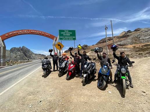
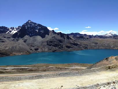
Leave early — it tends to cloud over and get colder on the puna around midday.
La Oroya — fuel and road junction.
Casapalca, a mining landscape in intense colors. On the final climb toward Ticlio, Laguna Huacracocha appears beside the road — with a clear sky, it's the last great Andean landscape postcard before the descent to the coast.
Abra Anticona / Ticlio, 4,818 m a.s.l. — the roof of the route, one of the highest paved road passes in the world. Stop for the photo (everyone does) but don't linger without warm layers: atmospheric pressure up there is almost 50% lower than at sea level, and many travelers feel altitude sickness (soroche) just stepping off the bike. Right at the highest point stands a monument to Ernest Malinowski, the engineer who designed this railway, sculpted by Gustaw Zemła — a great landmark for the summit photo. This is also where the 'Tren Macho' runs, which for over a century held the world's highest railway stretch.
On the way down the landscape changes fast: from the grey mining puna of Casapalca to the green of Matucana and Chosica.
Arrival in Lima, with nearly 2,900 km in the body and in the bike — you've earned a long hot shower and the right to tell this story.
- La Oroya (fuel and road junction)
- Casapalca (mining landscape in intense colors)
- Ticlio / Abra Anticona (4,818 m a.s.l. — roof of the entire route)
- Matucana and Chosica (already descending, temperate climate)
Tips for this route
Acclimatize before pushing altitude
Spend at least one full day acclimatizing in Cusco or Puno before tackling stretches above 4,000 m a.s.l. — altitude sickness (soroche) gives no warning.
Always leave before 7:00 a.m.
Weather changes quickly past midday, especially with fog — at altitude this is the rule, not the exception.
Never ride at night in the highlands
Loose livestock, fog, and lack of signage are the norm, not the exception.
Pack real warm layers
At Ticlio and Abra La Raya the wind-chill drops below 0°C even on a sunny day.
Fill up at every opportunity
Especially between Nazca and Camaná and on the Curahuasi–Abancay stretch: long gaps with no gas station.
Confirm Izcuchaca–Mayocc conditions
It's still being paved in sections; if conditions are bad, there's a longer but fully paved alternative via Huancavelica.
Coca leaf or coca tea
Helps with altitude acclimatization; it's legal and available in any highland market.
Which bike for this route?
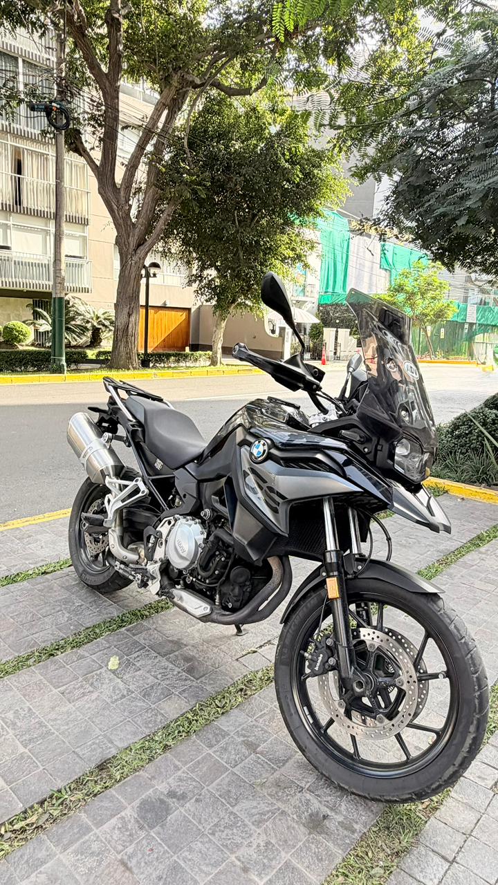
BMW F750GS
853cc
For the trip you've been planning for months.
400 km/day included: 5,200 km over 13 days for a 2,876 km route.
Ready for the 2,876 km?
Reserve the bike, start planning, and we will support you with everything you need before you set off.