Sun & Sand Route
4 days · 765 km
Lima, Lunahuaná, Paracas and Huacachina — 4 days, 765 km, no altitude sickness.
Lima, Lunahuaná, Paracas and Huacachina — 4 days, 765 km, no altitude sickness.
What is the Sun & Sand Route?
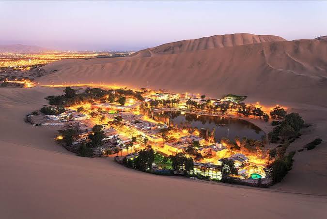
Four days to discover that the Peruvian south coast has everything: a canyon river valley where you can go whitewater rafting, a desert that meets the sea in Paracas, and a palm-tree oasis surrounded by giant dunes in Huacachina.
It is almost entirely on asphalt, with gentle elevation changes and no mountain passes, so it is perfect for riders taking their first multi-day trip or for anyone who wants a long weekend without altitude sickness or rain.
What you enjoy most here is not the riding technique but the scenery, the food (crayfish, chowder, tejas candy, pisco) and the stops.
Best season
March–May and September–November — sunshine in Ica and Paracas, without the extreme summer heat or Lima's thick winter fog.
Avoid
January–February (Ica exceeds 33–35 °C at midday) and June–August on the Lima exit due to dense coastal fog and cold damp mornings. Holy Week, national holidays and long weekends clog the Panamericana Sur: if you travel then, leave very early and return a day before the mass return.
The Paracas winds (the famous "paracas") blow hardest in August–September in the afternoons: cross the reserve in the morning. The Ica Harvest Festival (Vendimia) is in March — the city fills up, so book your hotel in advance.
4 days along the Peruvian south coast
Lima → Lunahuaná
coastal plain and Cañete river valley
Quick coffee, check tyres, chain, lights and documents. Leave Lima on the Panamericana Sur before traffic wakes up: at this hour you save yourself an hour of stress in Villa El Salvador.
You pass Lurín and Punta Hermosa. If it is cold, layer up: the Lima coastal mist wets your visor even when it is not raining.
Between Lurín and Chilca there is dense fog in the early morning almost every winter. Lights on, three-second gap from the truck ahead and no overtaking on blind corners.
Stop in Chilca or Asia to stretch, refuel and have breakfast. Fuel prices here are usually better than inside Lima.
You reach the Cerro Azul area, around km 131. It is worth a 5-minute detour to the old pier: the iron dock dates from the late 19th century, from the cotton era. Locals surround it with surfing legends, but the truth is that the cove has a sea view worth the detour.
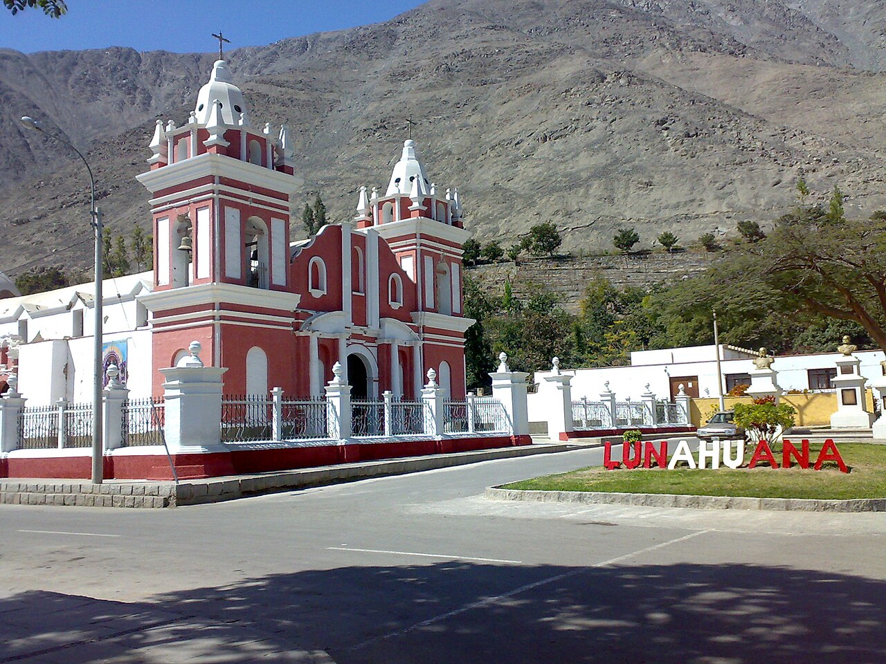
At San Vicente de Cañete (around km 144) take the left turn toward Lunahuaná on the Cañete–Yauyos road. Everything changes here: goodbye flat desert, hello green valley and gentle curves following the Cañete river.
The last 38 km are pure pleasure: sugarcane fields, vineyards, the river alongside and hills closing in. You will want to stop every 10 minutes for photos. Do it, but always off the roadway.
The Lunahuaná valley is one of the cradles of Peruvian pisco: its artisan bodegas work quebranta, italia and albilla grapes, and many still press with stone lagares.
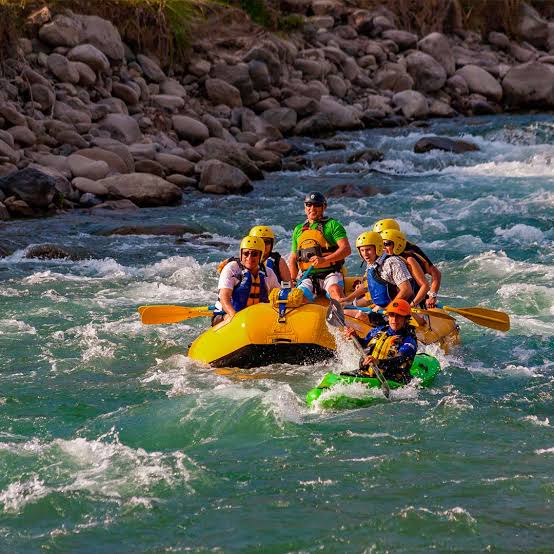
Arrival in Lunahuaná. Park the bike, change and head straight to lunch — crayfish: chowder, stone-grilled or in a causa. The Cañete river is nationally famous for its crayfish.
Afternoon whitewater rafting (class III–IV from December to April, calmer the rest of the year) or a visit to a pisco bodega in Catapalla or Paullo.
If you still have energy, take a short ride to the Catapalla suspension bridge and the Incahuasi ruins, an Inca administrative centre that served as a base for controlling the valley.
Light dinner and early to bed: tomorrow the stretch is long with plenty of trucks.
- Chilca or Asia (km 65–97): petrol, rest stop and breakfast
- Cerro Azul (km 131): historic pier and sea views
- San Vicente de Cañete: last major town before the turnoff
- Valley viewpoint before Lunahuaná: photos with the Cañete river
Refugio de Santiago Ecolodge — Lunahuaná, Paullo sector
Ecolodge among orchards and vineyards, with a closed internal car park where the bike sleeps safely. Quiet setting, home-cooked food with valley produce. For a more budget option, there are family guesthouses around the main square with gated garages; always ask for the bike to be brought inside the courtyard.
Lunahuaná → Paracas
descent to the sea and Panamericana Sur
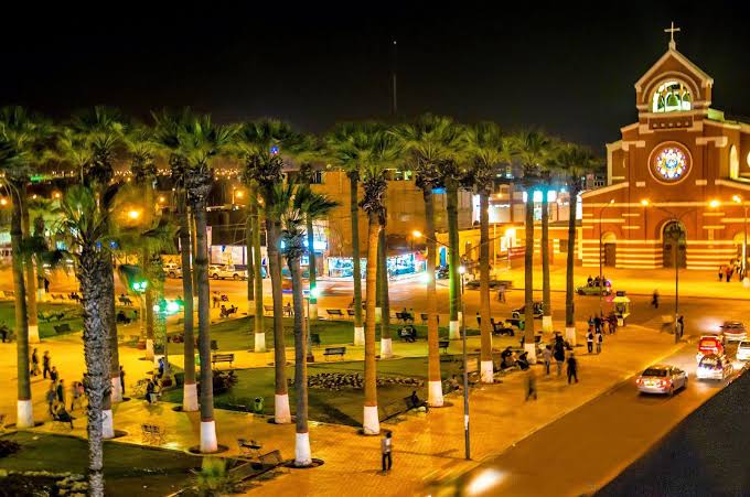
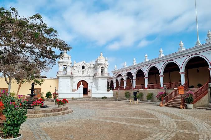
Hearty breakfast and on the road. You ride the 38 km back down to Cañete with the sun ahead and the valley still cool: the best time of day for these curves.
Rejoin the Panamericana Sur heading south. From here on it is straight road, trucks and desert. Fill up in Cañete: full tank whenever you can.
The Cañete–Chincha–Pisco stretch has heavy goods trucks, fast inter-city buses and mototaxis crossing the road through the towns. Avoid overtaking and do not trust the truck's indicator. Try to stay in the right lane.
Chincha Alta. Mandatory stop: this is where Afro-Peruvian culture lives in Peru. If time allows, detour 10 minutes to El Carmen and try a carapulcra con sopa seca — the definitive dish of Chincha.
Entire families of festejo and zapateo criollo musicians and dancers were born in El Carmen; in February the Verano Negro festival — the largest cultural celebration in the area — takes place there.
You pass through Pisco on the Los Libertadores road. You will still see traces of the 2007 earthquake (magnitude 8.0), which devastated Pisco, Chincha and Ica.
Arrival in Paracas, at the El Chaco waterfront. Park the bike, have a fresh fish lunch overlooking the bay and rest from the sun.
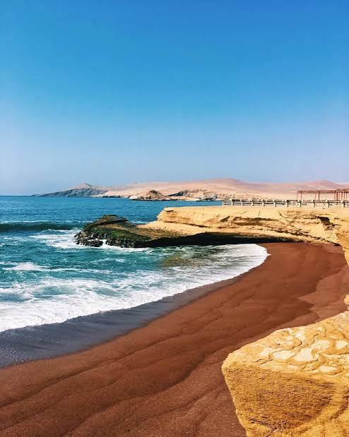
Short and stunning ride: you enter the Paracas National Reserve (admission ticket required, ID in hand). It is about 15–20 km of asphalt inside to Playa Roja and the Supay or Lagunillas viewpoints.
Inside the reserve there is windblown sand on the asphalt, especially on corners. Slow down, avoid sharp braking and do not try to leave the road: the bike can sink in seconds.
Sunset at La Catedral or the bay viewpoint. La Catedral formation partially collapsed in the 2007 earthquake, but the clifftop desert-meets-sea landscape is still dramatic.
Dinner on the waterfront and off to sleep. Tomorrow you need an early start for the Ballestas Islands.
- Cañete: fuel and last mechanical check before the straight
- Chincha Alta / El Carmen: carapulcra con sopa seca and Afro-Peruvian culture
- Fuel stop in Pisco before entering Paracas
- Lagunillas inside the reserve: cove with fish restaurants
Hotel San Agustín Paracas — Paracas, facing the bay
Seafront hotel with its own closed car park and 24-hour security. It is steps from the pier where the boats to the Ballestas Islands depart, so the next day you do not need to move the bike. Budget alternative: family guesthouses in El Chaco; check that they have an internal gated courtyard.
Paracas → Huacachina (Ica)
the shortest riding day, the longest tourist day
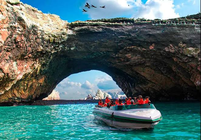
Short riding day, long tourist day. Early breakfast and straight to the pier.
Tour to the Ballestas Islands (about 2 hours). On the way you see El Candelabro, a geoglyph about 180 metres tall carved into the sandy hillside of the peninsula. Nobody knows for certain who made it: theories link it to the Paracas culture and others to 19th-century sailors.
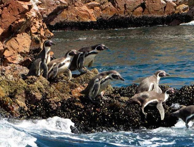
At the Ballestas you will see sea lions, Humboldt penguins and thousands of cormorants. Guano was harvested from these islands to sustain the Peruvian economy in the 19th century; it is still harvested in a controlled way today.
Bring a windbreaker jacket and a cap: the boat goes fast, the wind is cold and the birds... well, they do what they do.
Back on land, coffee, and at 11:30 you head for Ica. It is barely 75–80 km on the Panamericana: straight, with dunes on both sides.
Before entering Huacachina, stop at an Ica bodega: Tacama (one of the oldest wineries in the Americas) or Vista Alegre. A short tasting, nothing excessive — you still have 15 minutes of riding to go.
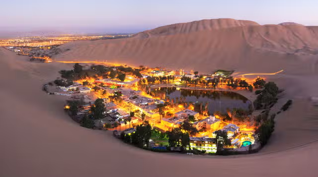
Arrival at Huacachina, the oasis in the middle of the dunes. Bike in the garage, lunch and a nap: at that hour the heat of Ica knocks you flat.
Legend has it that an Inca princess was bathing in the lagoon and, surprised by a hunter, fled leaving her cloak: the cloak became the lagoon and she became a mermaid who still lives in the water. That is why the oasis is called "the oasis of the Americas".
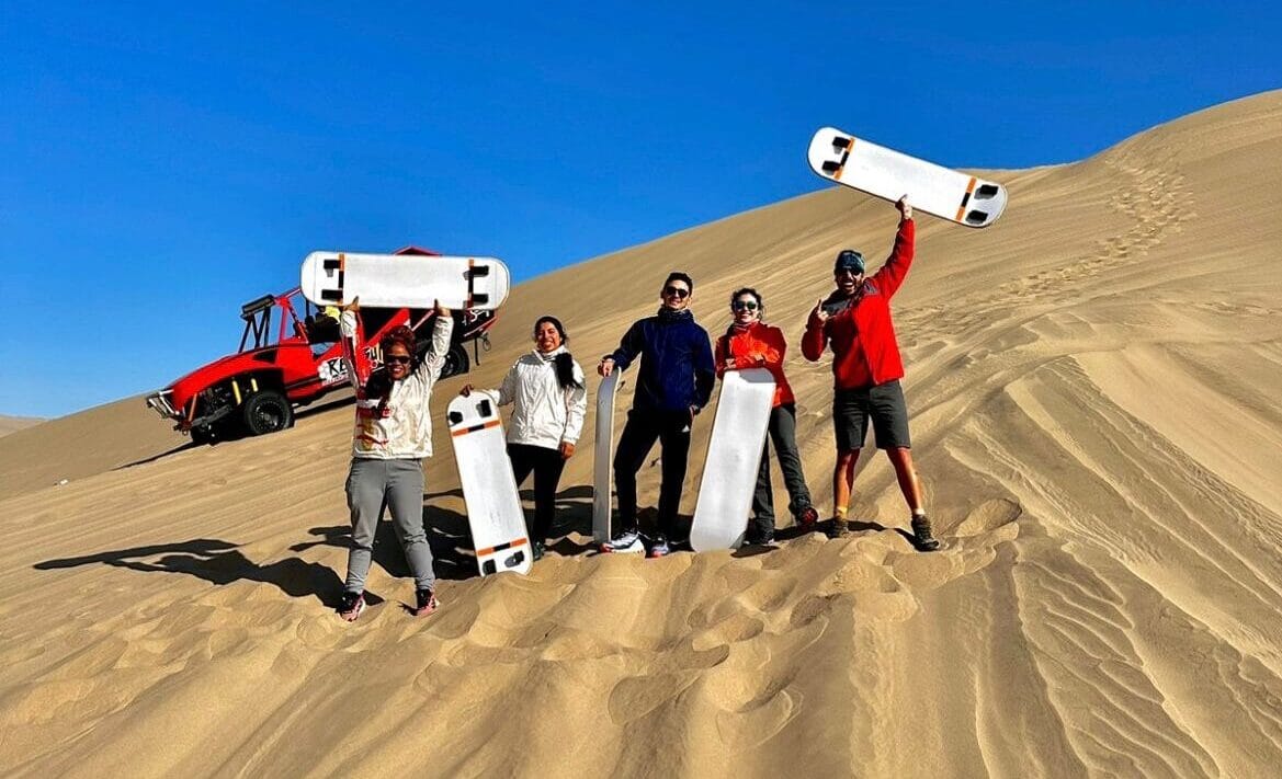
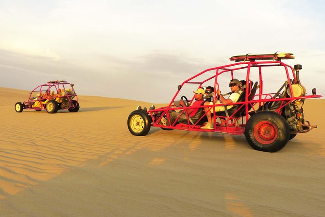
Dune buggy and sandboard tour — this IS done in a buggy with a proper operator, never on your street bike. Choose a company with insurance and a driver with a special permit.
Sunset from the big dune behind the oasis. The postcard shot of the trip.
Dinner on the lagoon waterfront and a well-chilled pisco sour, with the bike already locked away.
- El Chaco pier: departure point for the Ballestas tour
- Fuel stop at the exit of Pisco or the entrance of Ica
- Bodega Tacama or Vista Alegre (Ica): pisco and wine tasting
- Tejas candy shop on the highway
Hotel Curasi — Huacachina, facing the lagoon
A classic of Huacachina, with a pool to beat the Ica heat and an internal courtyard where you park the bike under lock and key. Another highly recommended option is the Hostería Suiza, quieter with a closed garden — ideal if you want to sleep without party noise.
Huacachina (Ica) → Lima
long desert straightaway and descent to Lima
Last morning. Early breakfast and off before 7:00: the return is long and you want to reach Lima before the afternoon traffic.
Full tank in Ica before joining the Panamericana Norte. From here to Chincha is almost 100 km of pure straight road.
The desert straight between Ica and Chincha is hypnotic and tricks you with speed. Stop every 60–80 km even if you do not feel tired, hydrate and stretch your legs. Most accidents on this stretch are caused by microsleep and low-visibility overtaking.
Stop in Chincha for a second breakfast or to pick up tejas and chocotejas as gifts. If you missed it yesterday, this is your carapulcra moment.
You cross Cañete and Asia. From here the Lima humidity starts to creep in; if it is winter, prepare for the temperature drop and a fogging visor.
This entire coastline was the territory of the Chincha culture, great pre-Hispanic seafarers and traders who reached Ecuador on totora and wooden rafts. They later joined the Tahuantinsuyo while retaining considerable autonomy.
Entry into Lima via Lurín and Villa El Salvador. Here the relaxed ride ends and the city begins: defensive riding, watch for combis, do not lane-split between buses and keep your distance.
Arrival in Lima. Bike in the garage, odometer photo and a closing ceviche. Four days, three distinct landscapes and zero altitude sickness.
- Chincha Alta: breakfast, tejas and chocotejas
- San Vicente de Cañete: fuel and lunch if traffic is heavy
- Asia or Pucusana (km 97 / km 57): coffee and last check
- Cerro Azul viewpoint: last sea view before Lima
Tips for this route
Leave before 6:30 a.m.
After that hour the Panamericana Sur around Villa El Salvador and Lurín becomes a bottleneck of buses and trucks.
Carry some cash just in case
On some stretches data signal fails and card payment may not work at fuel stations, restaurants or small car parks. Keep some soles on you so you are not stranded.
Toll booths on the Panamericana Sur
Motorcycles do not pay tolls. Stay in the right lane when passing booths and ride through without stopping; the right lane is usually free for bikes.
Desert sun burns even when overcast
Use a helmet with a tinted visor or sunglasses, gloves, sunscreen on your neck and drink water at every stop.
Lima coastal fog (May to September)
Between Lurín and Chilca visibility can drop badly in the early morning. Lights always on and a reflective vest.
Never leave the bike alone on the beach
Always use the hotel's closed car park or a supervised parking area; same rule at the Huacachina dunes.
Loose sand on the asphalt
In Huacachina and the Paracas Reserve, brake before the corner, not inside it. Never take a street bike onto the dunes.
Pisco only once the bike is parked
Police checkpoints on the road include breathalyser tests. Bodegas: end of day only, never before riding.
Which bike for this route?
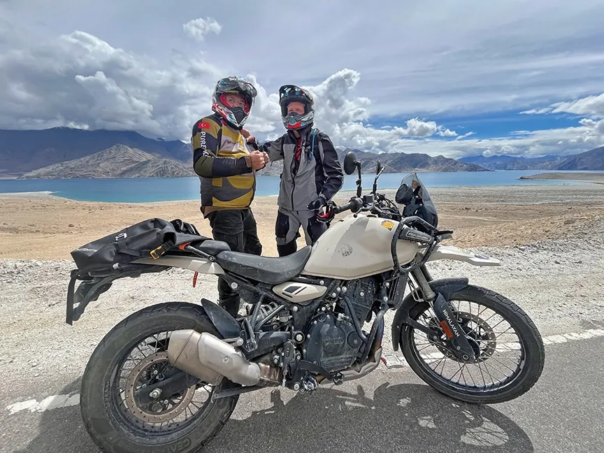
Royal Enfield Himalayan 450 · 452cc
See details →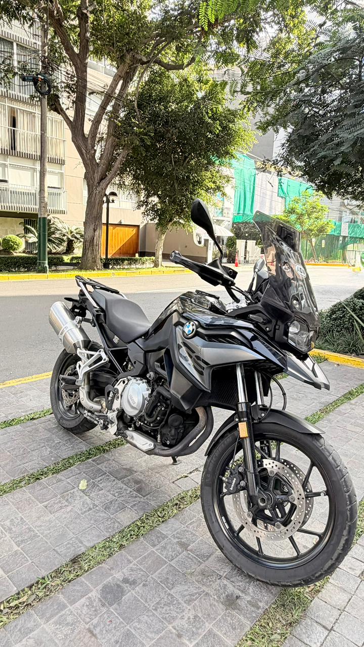
BMW F750GS · 853cc
See details →Ready for the 765 km?
Book your bike, plan the route and we'll support you with everything you need before you set off.